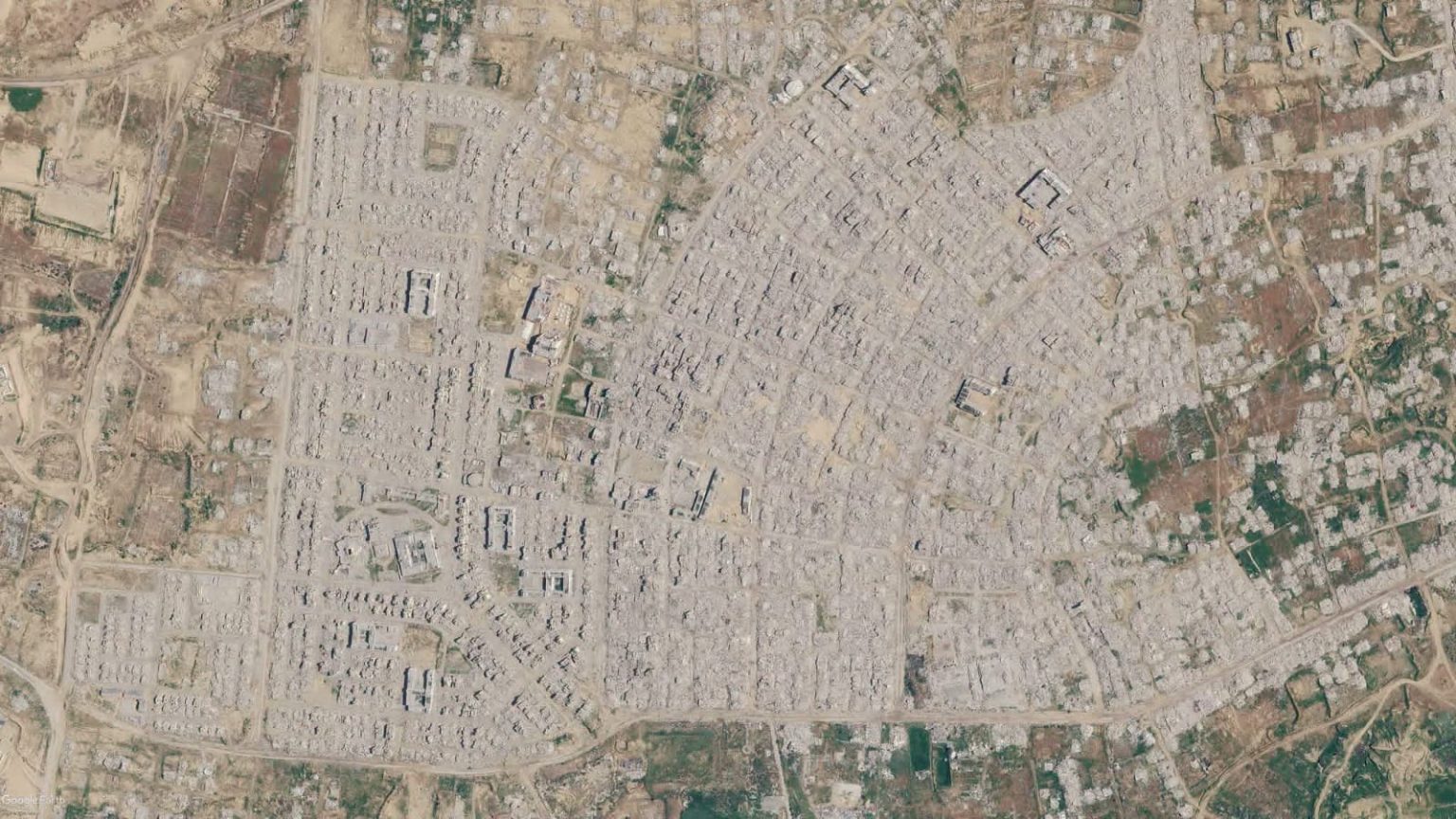
RAFAH, (Palestine Foundation Information Center), Recent aerial photographs have revealed the vast scale of destruction carried out by Israeli occupation forces, wiping out entire residential neighborhoods in the southern Gaza cities of Rafah and Khan Yunis.
Captured via Google Earth Pro, the images show large areas leveled to the ground, with civilian infrastructure, including homes, schools, and service facilities, completely erased.
The footage highlights a recurring pattern of total destruction, reinforcing evidence of systematic targeting of populated areas.
These scenes reflect the immense destructive power deployed by the Israeli occupation army, extending beyond isolated sites to engulf entire neighborhoods and cities such as Rafah.
Experts in international humanitarian law stress that this scale of devastation constitutes grave violations prohibited under international law, including the targeting or disproportionate destruction of civilian objects.
They further note that the repetition of this pattern across multiple locations strengthens the case for deliberate intent to inflict comprehensive damage on the urban environment and social fabric.
The aerial images carry special documentary value, providing direct visual evidence of the nature and scale of Israeli crimes. They bolster international calls for independent, transparent investigations, accountability for acts of genocide, and the protection of civilians in line with international legal standards.